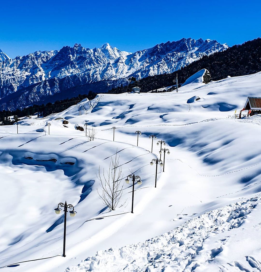
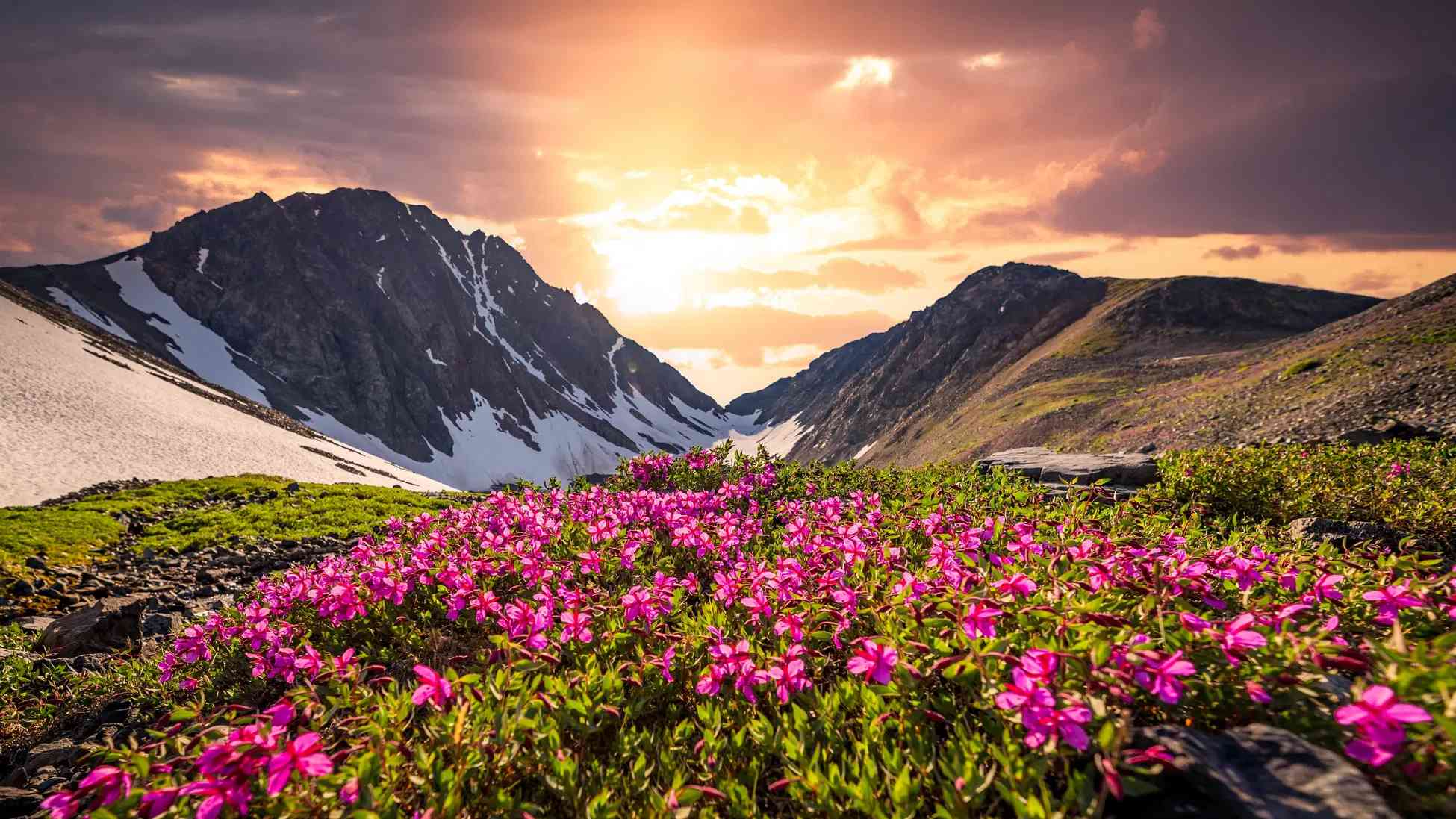
Tucked away high up in the hills of Uttarakhand, Auli is a serene hill station resting at nearly 2,800 meters above sea level. It’s a peaceful snow-covered slope in the Chamoli district, nestled among the Garhwal Himalayas. Locals also call it “Auli Bugyal,” meaning meadow, and the name fits—it’s a place where grasslands meet snowfields, depending on the season.
Niti Valley — Where the Road Ends and Stories Begin
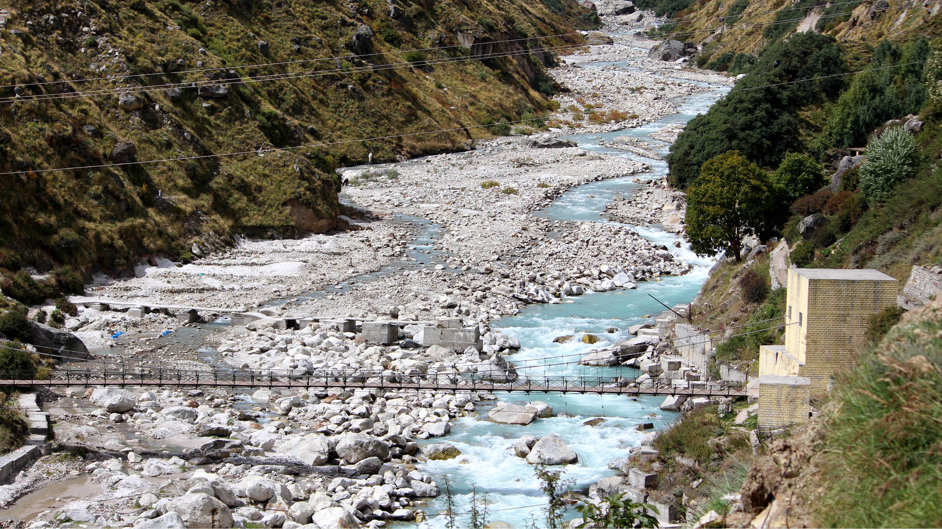
Where is Niti Valley?
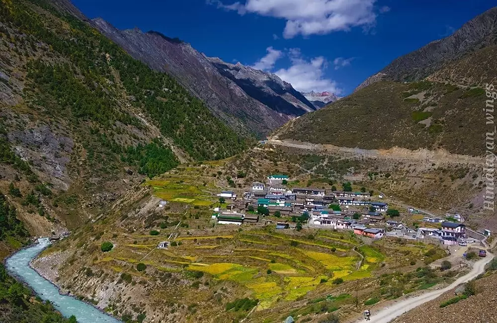
Tucked deep in the upper reaches of Chamoli district in Uttarakhand, Niti Valley rises gracefully to nearly 3,600 meters above sea level. It’s a remote, soul-stirring place near India’s border with Tibet, where the village of Niti marks the last human settlement before the land disappears into the high Himalayas. The valley once served as an ancient trade route through the towering Niti Pass—now closed—but its aura of untouched mystery still lingers.
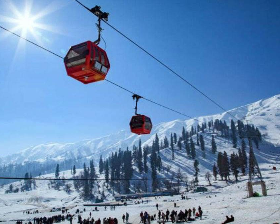
Auli Ropeway – Where the Ride is as Stunning as the Destination
So, what is it?
If you’re heading to Auli, there’s no better way to get there than floating above the Himalayas in the famous Auli Ropeway—a cable car that connects the town of Joshimath (at about 1,875 meters) with Auli (which sits much higher, around 3,010 meters). The ride covers about 4 kilometers of sheer mountain beauty and is one of the longest and highest ropeways in Asia. And yes, it’s a lot more than just transportation—it’s an experience.
Tucked away in the lofty heights of Chamoli district, Uttarakhand, this national park surrounds the awe-inspiring Nanda Devi peak, which soars up to 7,816 meters. It’s part of the celebrated UNESCO World Heritage Site, along with the nearby Valley of Flowers. Covering more than 630 square kilometers, the park is a rugged paradise of alpine terrain, glaciers, wild rivers, and towering peaks. The journey into the park typically begins from Lata village, which sits at around 2,100 m and leads up to the sanctuary near 7,500 m above sea level.
Tucked away high up in Chamoli district of Uttarakhand, the Valley of Flowers is like something out of a dream. Spread across about 87 square kilometers, this lush alpine valley is part of the Nanda Devi Biosphere Reserve, and sits at an altitude of 3,352 to 3,658 meters. Surrounded by snow-draped Himalayan peaks, the valley transforms into a riot of colors every monsoon, with carpets of blooming wildflowers and sweet-scented meadows.
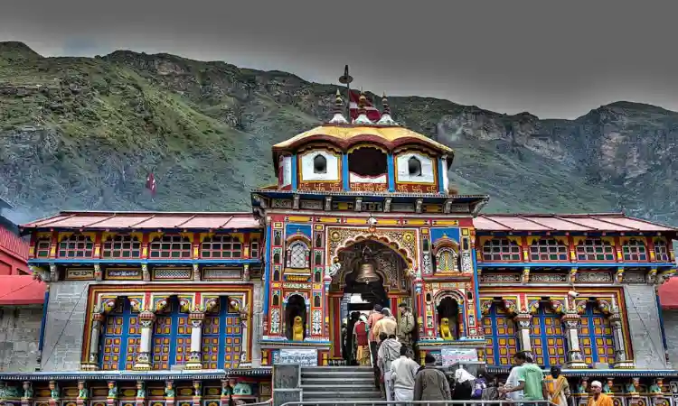
Badrinath is a beautiful town tucked away in the Chamoli district of Uttarakhand, sitting high up at around 3,100 meters above sea level. It lies along the banks of the Alaknanda River and is surrounded by snow-capped Himalayan peaks.
At its heart is the famous Badrinath Temple, dedicated to Lord Vishnu. It’s one of the four Char Dham pilgrimage sites that every Hindu dreams of visiting at least once in their life. The temple, originally established by Adi Shankaracharya in the 9th century, has been restored over the centuries and reflects a beautiful mix of traditional Garhwali woodwork and intricate stone architecture.
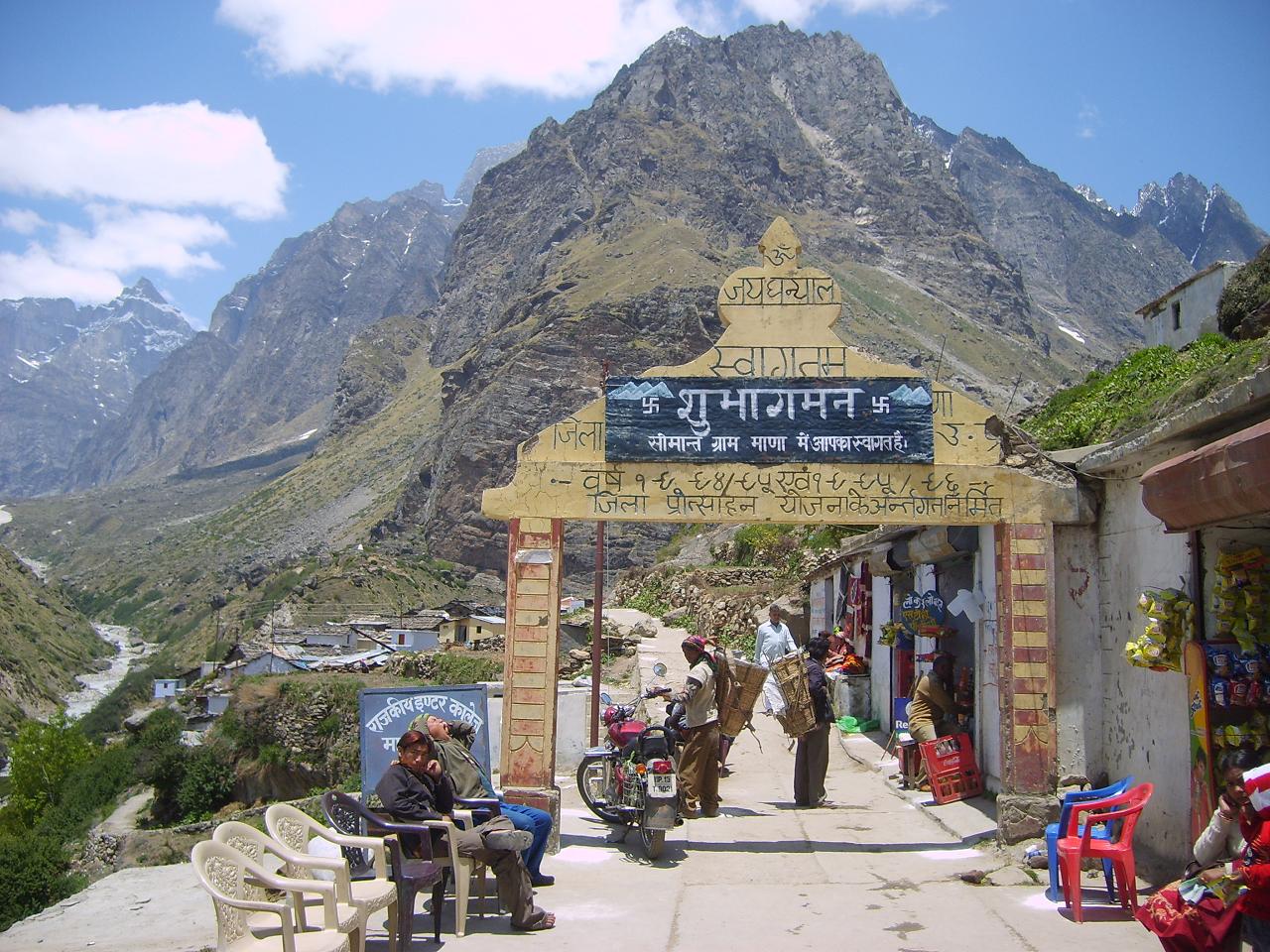
Tucked away in Uttarakhand’s Chamoli district, at an altitude of about 3,200 meters (10,500 ft), Mana Village proudly holds the title of India’s last village before the Tibet border. Just 3 km from the sacred town of Badrinath, this peaceful hamlet sits beside the Saraswati River, which locals believe mysteriously vanishes underground—a belief deeply rooted in ancient Hindu mythology.
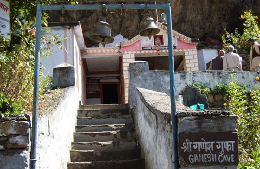
Just a short 4 km from the temple town of Badrinath, tucked into the edge of Mana Village, lies Ganesh Gufa—a quiet, sacred cave believed to be the place where Lord Ganesha wrote down the Mahabharata as it was narrated by sage Ved Vyasa.
Set against a peaceful Himalayan backdrop, the cave has a calm, spiritual vibe. It’s not just another tourist stop—it’s the kind of place that invites silence, reflection, and a real sense of history and divinity.
Tucked away in the quiet village of Mana, just a few kilometers from Badrinath, lies a powerful little spot known as Saraswati Cave or the Saraswati Spring. This is where the Saraswati River, steeped in ancient mythology, briefly shows itself before vanishing underground—earning it the name “Gupt Gamini,” or the hidden river.
From here, the Saraswati flows only for a short stretch before it disappears beneath the rocks, later merging with the Alaknanda River at a sacred confluence called Keshav Prayag.